April 2020
diplomacy gameboard
Note: this is Part 2 of my ongoing Diplomacy project: Part 1 can be found here.
Alright, quick intro time: One of my favorite boardgames is an old one called “Diplomacy.” If you’re unfamiliar, think “Risk” -- trying to outmaneuver
opponents and occupy territories with your army pieces -- mixed with healthy elements of bluffing, strategy, and of course, diplomacy with the other players.
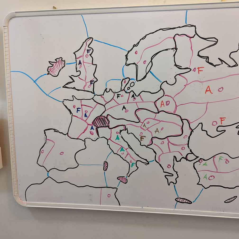 Anyway, since I’ve been playing a socially-distant version with some friends, I figured it was a good time to take a crack at making my own game board (I
don’t already own the game, myself). Originally, it started with just a sketch on the whiteboard, which eventually developed into a desired to create an actual board.
Anyway, since I’ve been playing a socially-distant version with some friends, I figured it was a good time to take a crack at making my own game board (I
don’t already own the game, myself). Originally, it started with just a sketch on the whiteboard, which eventually developed into a desired to create an actual board.
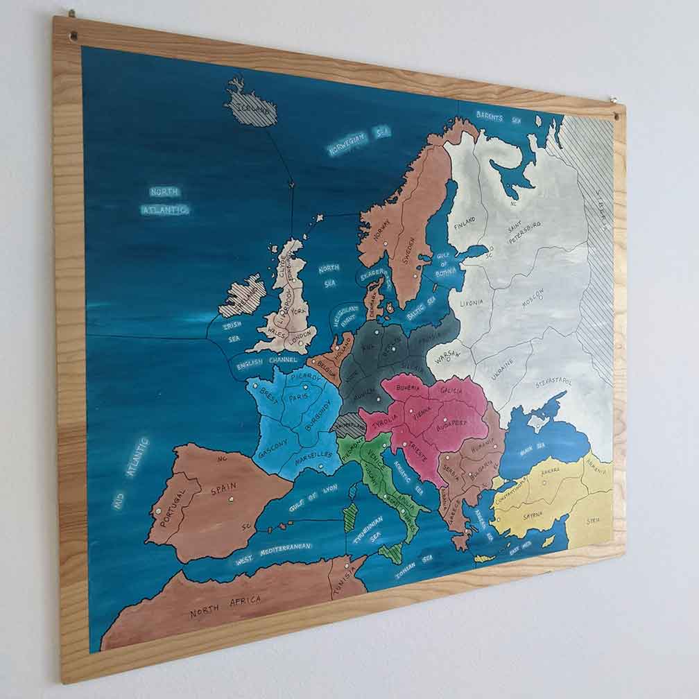
The traditional gameboard focuses on Europe, dividing up the continent and some surrounding regions into more-or-less historically accurate pre- World War 1 territories. At the beginning of the game, most of these territories are controlled (and color-coordinated) by one of the seven player-controlled Powers: Great Britain, France, Italy, Germany, Turkey, Russia, and Austria-Hungary.
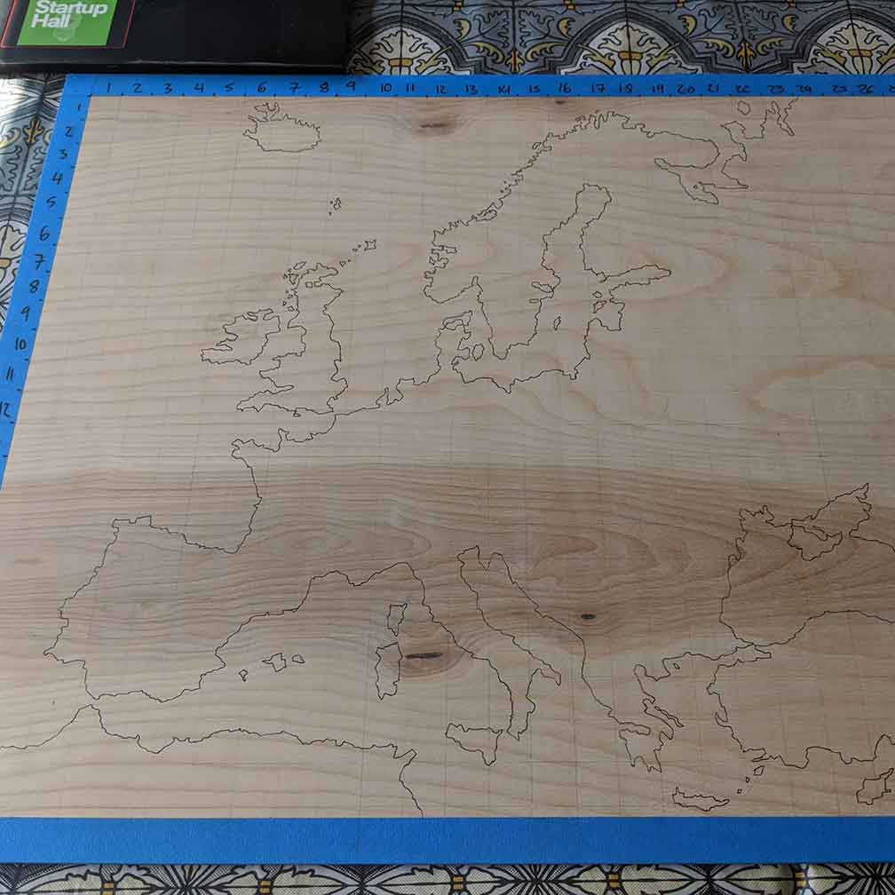 My first task was to get the coastal outline on the piece of plywood
I had chosen for the board. I found an image of the traditional board layout online, overlaid a grid in Photoshop, and recreated this grid on my physical board. Then, it was
just a matter of painstakingly replicating the image, cell by cell, until I had a complete and relatively accurate coastline. However, all my hard work was soon undone by
poor planning.
My first task was to get the coastal outline on the piece of plywood
I had chosen for the board. I found an image of the traditional board layout online, overlaid a grid in Photoshop, and recreated this grid on my physical board. Then, it was
just a matter of painstakingly replicating the image, cell by cell, until I had a complete and relatively accurate coastline. However, all my hard work was soon undone by
poor planning.
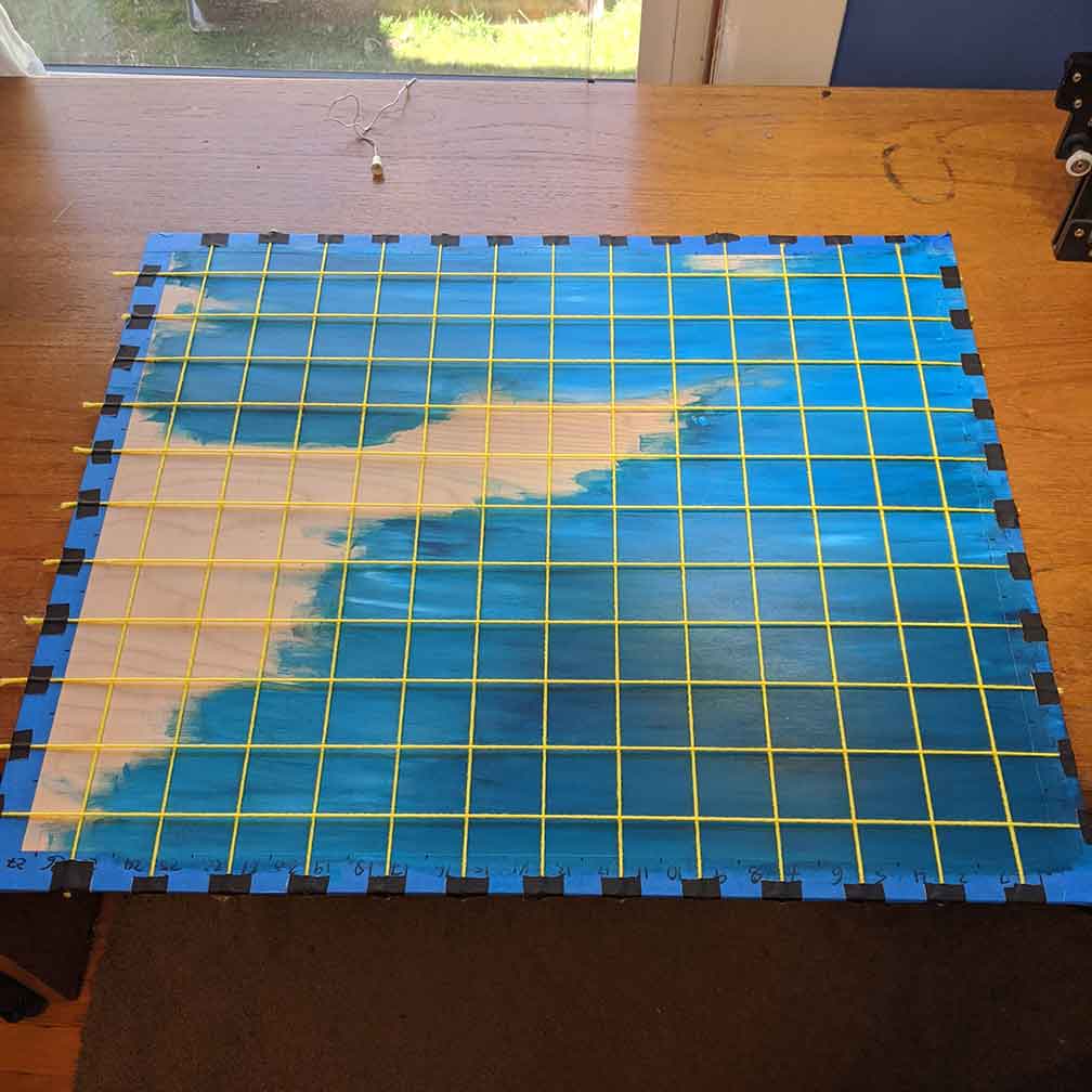 It was at this point that I decided to paint in the water. I settled on a technique of overlaying darker blue hues and white, brushing them back and forth
repeatedly, to create some texture and contrast in my water -- I didn’t want a single, bland shade of water. However, this technique had the downside of completely
covering the coastlines (and grid system) that I had so laboriously laid out. My solution, after some head-scratching, was to use yarn stretched across the board to
temporarily recreate my grid, and use this to lay out my coastline once more.
It was at this point that I decided to paint in the water. I settled on a technique of overlaying darker blue hues and white, brushing them back and forth
repeatedly, to create some texture and contrast in my water -- I didn’t want a single, bland shade of water. However, this technique had the downside of completely
covering the coastlines (and grid system) that I had so laboriously laid out. My solution, after some head-scratching, was to use yarn stretched across the board to
temporarily recreate my grid, and use this to lay out my coastline once more.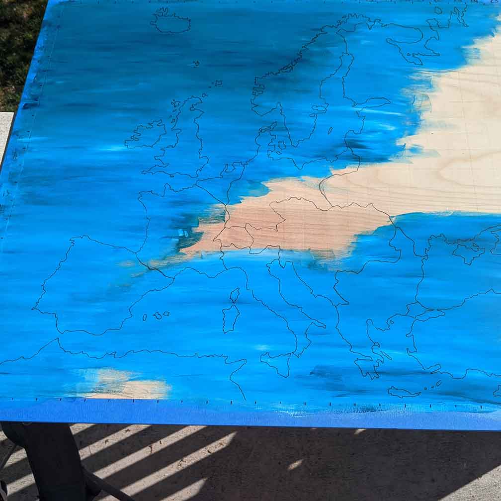
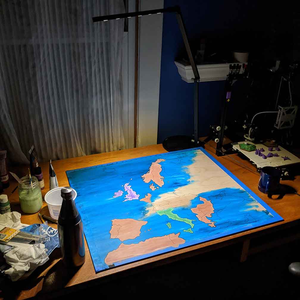 Next, I started painting in the different colors used for the
player nations and unclaimed territories -- I decided to mix in some white at each color’s border, to make them pop a bit and add some visual interest -- while
there is some variance, I think this turned out really well. Lacking my grid once again, I eyeballed the secondary, internal territory lines. It was at this point
that I was stepping back and looking at the project, and starting to get really proud of how it was coming together.
Next, I started painting in the different colors used for the
player nations and unclaimed territories -- I decided to mix in some white at each color’s border, to make them pop a bit and add some visual interest -- while
there is some variance, I think this turned out really well. Lacking my grid once again, I eyeballed the secondary, internal territory lines. It was at this point
that I was stepping back and looking at the project, and starting to get really proud of how it was coming together.
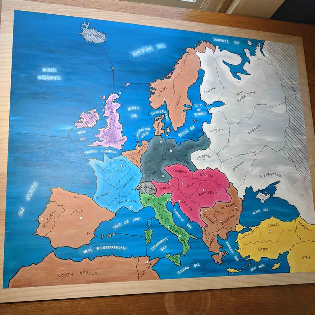
The final pieces were quick -- some labels and a few coats
of polyurethane, and it was a wrap! I also printed and painted a bunch of game pieces (little army and navy tokens), so now the game is fully playable, and I think
it turned out great.